Forest on foot
Rung Sac and the monkeys
The site tour, walking and canoe
- Day9 hours
- Forest time2.5 hours
- Pricefrom $33
Pick out your stop
Look at 24 stops
Choose a route and tap a pin or stop to see its note and open it in Google Maps.
A point inside the reserve, which was recognized as a biosphere reserve on January 21, 2000.
Google MapsAn office of the body that manages the protection forest of Can Gio, set inside the forest.
Google MapsA point on Rung Sac Road, the main road to the reserve, which runs more than 36 km from the ferry terminal.
Google MapsMonkey Island lies a short distance from the Rung Sac base, within the biosphere reserve.
Google MapsDirections to Vam Sat in a 2018 report cross the Vam Sat and Goc Tre bridges after the ferry.[[@vs_bridges]]
Google MapsA 2018 report located the Vam Sat site at Ly Nhon Ward.[[@vs_lynhon]] The park gate itself is not pinned, since no verified coordinates were available.
Google MapsThe market in Can Gio town, a landmark for orientation. The site tour lists its own seafood market stop.
Google Maps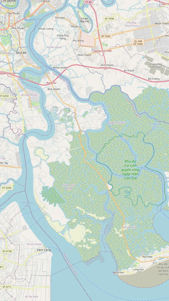
The river crossing where the road to Can Gio turns into a ferry ride. Rung Sac Road begins at this terminal.
Google MapsDirections to Vam Sat in a 2018 report cross the Vam Sat and Goc Tre bridges after the ferry.[[@vs_bridges]]
Google MapsA 2018 report located the Vam Sat site at Ly Nhon Ward.[[@vs_lynhon]] The park gate itself is not pinned, since no verified coordinates were available.
Google MapsAn office of the body that manages the protection forest of Can Gio, set inside the forest.
Google MapsA point inside the reserve, which was recognized as a biosphere reserve on January 21, 2000.
Google MapsA point on Rung Sac Road, the main road to the reserve, which runs more than 36 km from the ferry terminal.
Google Maps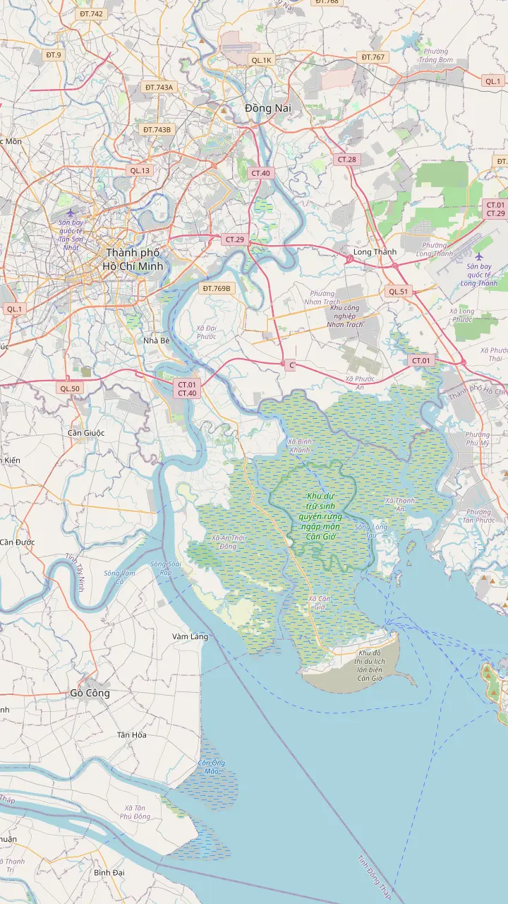
A central landmark of the city, used here only as the starting point for the road to the coast.
Google MapsThe river crossing where the road to Can Gio turns into a ferry ride. Rung Sac Road begins at this terminal.
Google MapsDirections to Vam Sat in a 2018 report cross the Vam Sat and Goc Tre bridges after the ferry.[[@vs_bridges]]
Google MapsA point on Rung Sac Road, the main road to the reserve, which runs more than 36 km from the ferry terminal.
Google MapsMonkey Island lies a short distance from the Rung Sac base, within the biosphere reserve.
Google MapsThe market in Can Gio town, a landmark for orientation. The site tour lists its own seafood market stop.
Google Maps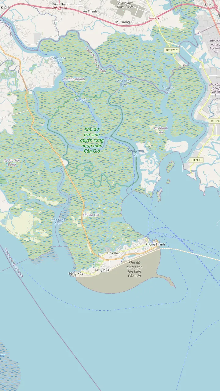
A point on Rung Sac Road, the main road to the reserve, which runs more than 36 km from the ferry terminal.
Google MapsMonkey Island lies a short distance from the Rung Sac base, within the biosphere reserve.
Google MapsAn office of the body that manages the protection forest of Can Gio, set inside the forest.
Google MapsThe market in Can Gio town, a landmark for orientation. The site tour lists its own seafood market stop.
Google MapsA point inside the reserve, which was recognized as a biosphere reserve on January 21, 2000.
Google Maps© OpenStreetMap contributors · map data
A guide to the green belt south-east of Ho Chi Minh City: where the reserve begins and ends, what the zoning means, how the trees came back and where the visitor sites sit on the map.
Editorial team, cangiotour.quest · Updated November 16, 2026 · ~9 min read
The Can Gio mangrove forest in Vietnam is a coastal reserve at the edge of Ho Chi Minh City, where the delta rivers hand their silt to the sea. The Nature and Biodiversity Conservation Agency, which sits inside the national environment ministry, records that the reserve was recognized on January 21, 2000.1 A Vietnam News Agency feature calls it the first Mangrove Biosphere Reserve in the country.6
UNESCO places the reserve in the coastal district south-east of the city, on a continuum from the coast to the edge of the biggest industrial city in Viet Nam.7 The state agency adds that the reserve is a complex of land and water forest, animals and plants, formed on the delta where the Dong Nai, Saigon and Vam estuaries meet.8 In plain terms, this is not a single park with a gate and a ticket office. It is a whole landscape of channels, mud flats and forest, and the visitor sites are small clearings inside it.
How far away is it? Vietnam Pictorial, a VNA publication, gives 50 km south-east of the city centre,9 and an older VNA piece says nearly 60 kilometres.10 Treat both as approximations of a road-and-river trip rather than a surveyed line. Getting there is covered on a page of its own, which leaves the forest itself as the subject here: it lies close to the city without being next door.
Species counts
| Group | Recorded | Note |
|---|---|---|
| Mangrove species | 525 | True and associate species |
| Animal species | 2005 | As the VNA species note counts |
| Bird species | Over 405 | Plus a larger sanctuary count in the Ramsar file21 |
| Mollusc species | 1822 | Recorded at the site |
| Crustacean species | 2722 | Recorded at the site |
| Fish species | 4522 | Recorded at the site |
Counts come from a Vietnam News Agency species note and are tallies of recorded species, not guarantees of what you will see.5
Anyone checking the UNESCO status of the Can Gio mangrove forest soon meets numbers that disagree, and it helps to know where each comes from. On UNESCO's count the reserve spans 75,740 ha, made up of a 4,721 ha core, a 41,139 ha buffer and a 29,880 ha transition belt.2 The national conservation agency lists the same zone sizes and a total above 75,000 hectares,15,16 while older press reports round the whole down to over 70,000 hectares.17
Mangrove cover is a smaller number than the reserve itself. Vietnam Pictorial counts more than 33,900 hectares of mangroves and calls it among the most extensive rehabilitated mangrove forests in the world.3 A report on the city's Ramsar nomination speaks of a mangrove area of nearly 35,000 hectares.18 The sources do not always say what each figure measures, so read them as different cuts of the same landscape: the reserve, its zones and the trees inside it.
For a visitor the zones matter more than the headline area. Residents live mostly in the transition belt, where UNESCO counts almost 70,000 people,19 while the core and the buffer hold only rangers, forestry staff and a handful of fishermen using traditional shrimp traps.20 Tour sites cluster where the forest meets roads and jetties, and most of the protected ground is simply not a place you walk into, which is the idea of a reserve.
The land has a name that predates the reserve. The conservation agency notes that since 1929 the area has been called the forbidden forest of Quang Xuyen - Can Gio,11 and it also goes by the name Sac Forest. During the wars the Rung Sac Special Task Force used it as the base from which it operated,27 and the Vietnam Pictorial feature describes it as a key battleground that US forces devastated by spraying toxic chemicals.28
The scale of the loss is the number to remember. The agency's account says toxic chemicals were sprayed many times over nearly 10 years, from 1964 to 1972, and that more than 80% of the mangrove forest died, ancient trees included.4 Large tree stumps from that time still lie in the mud.29 A VCCI report says dioxin left the whole forest bare after 1975, and that monkeys only began to reappear by the early 1990s.12
Recovery was deliberate work rather than luck. A VNA report dates the joint effort of the city authorities and residents to 1985,13 and the conservation agency says the replanting project that followed April 30, 1975 won the Ho Chi Minh Science and Technology Award.30 Today the plantation mangrove covers about 20,000 ha, with about 7,000 ha of naturally regenerating mangrove beside it.31 A good share of the green you pass from a boat is plantation mangrove, and that replanting is part of the forest's story.
Pick your forest
Choose what you came for and see which side of the reserve to ask your operator about.
If I want the war history
The Rung Sac base
The base is reconstructed inside the mangroves with lifelike displays.23
If I want birds and bats
The Vam Sat side
Bat swamps and a bird sanctuary sit around Vam Sat.24
If I want to see monkeys
Monkey Island
Monkey Island sits near the base, inside the reserve.25
If I want the quietest water
A canoe in the channels
Tour records list canoe rides as an extra fee or included, depending on the day.
If I want to understand the ecology
Read this page first
The forest buffers storms and erosion, as the VNA account explains.26
Ways to enter the forest
Forest on foot
The site tour, walking and canoe
Bat lagoon
A boat to the bat sanctuary
By canoe
Canoe rides in the mangroves
The forest holds 52 mangrove species, both true and associate, along with 200 animal species and more than 40 kinds of bird, according to the VNA note.5 That note also tallies 18 mollusc, 27 crustacean and 45 fish species recorded at the site.22 Locals regard the forest as the green lungs of the city, UNESCO notes, and it rates the variety of mangrove plants, invertebrates, fish and shellfish here as the highest in the sub-region.36
Among the fauna UNESCO lists for the reserve are the king cobra, the saltwater crocodile, the spot-billed pelican and the fishing cat.37 Treat that as a list of what lives in the wider reserve, and not as a promise for your day. The VNA species note says there are only anecdotal reports of a farmer shooting an estuarine crocodile here around 1990, with no records since then,38 so the crocodiles on a tour belong to attractions and not to open water.
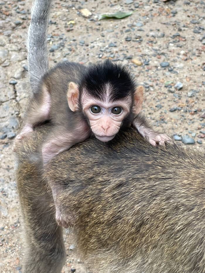
What a visitor sees is mostly the easy wildlife: mudskippers on the banks, crabs in the roots, birds on the wing, and the long-tailed macaques around the Rung Sac area. The Viet Nam News team describes monkeys, crocodiles, migratory birds and aquatic species living in the restored forest.39 For the monkeys, the Monkey Island page has the detail, and for the birds and bats the Vam Sat page does the same. Here the useful rule is to look more slowly at the water edge than you would at a zoo.
Price a forest day
Add a party size and watch the cost of each group day into the forest appear.
Weigh up 4 options
Add a party size and watch the cost of each group day into the forest appear.
≈
View≈
View≈
View≈
ViewStarting prices as on the booking platform, converted at the ECB reference rate. You see the exact price at booking.
A forest's story
Before the war
The area had carried the name forbidden forest of Quang Xuyen - Can Gio since 1929.11
The spraying years
Spraying lasted nearly 10 years, from 1964 to 1972.4
After the war
After 1975 the whole forest was bare, according to a VCCI report.12
Replanting
Authorities and residents began replanting efforts in 1985.13
Recognition
UNESCO recognition followed on January 21, 2000.1
Today
A Ramsar nomination was filed by the city.14
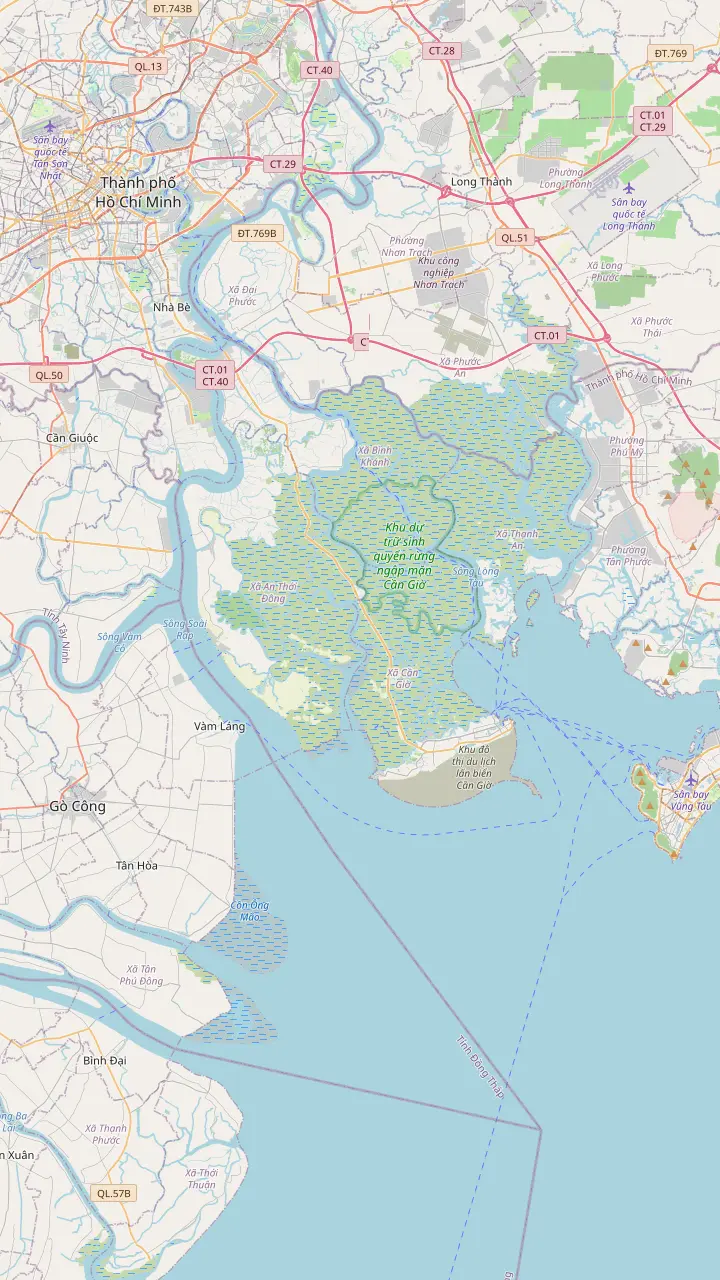
The map above has several views. The reserve view places the forest board's office, the Rung Sac forest, Monkey Island, the Vam Sat bridge, the Ly Nhon hamlet and the Can Gio town market, to show how little of the reserve the tours touch. The route view starts at Ben Thanh Market in the city centre and shows the Binh Khanh ferry, which is where road travel to Can Gio turns into a river crossing. Tap any pin for its note.
Rung Sac Road is the corridor that carries visitors: more than 36 km from the Binh Khanh ferry terminal to Long Hoa Commune, in VietNamNet's description.32 Almost everything you can visit on a day trip hangs off it, with the Rung Sac base and Monkey Island close together in the forest, Can Gio town a short way on, and Vam Sat reached by a different bridge route.
If you search for a Can Gio mangrove forest map before booking, the practical question is which part of the forest a tour enters. A route that stays on Rung Sac Road meets the base and the monkeys, while a route to Vam Sat crosses the Vam Sat and Goc Tre bridges after the ferry.40 The pins on this page follow the same logic. Where an attraction has no verified coordinates, the map names the nearest bridge or hamlet instead of guessing.
Video
Lux Travel DMC on YouTube · Your tap on play is what loads the video.
performs many valuable ecological functions, including coastal stabilisation, and protection against coastal erosion, oil spills and storm surges
Before you enter
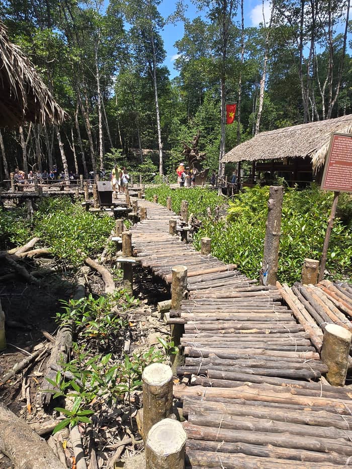
The itinerary of the site tour allots 2.5 hours to the reserve itself, and the Rung Sac Revolutionary Base on that day is reached on foot or, for a fee, by canoe. Plan on shoes that can take mud, a hat, and a little patience: forest time is a mix of walking and water, and the order of the two depends on the tide.
The base itself is a reconstruction among the mangroves, which VietNamNet says uses lifelike displays of soldiers in action,23 and a VNA feature recounts that the unit was founded in April 1966.41 VNAT's rural tourism page adds that operations such as attacks on enemy vessels and the raid on the Nha Be fuel depot were launched from this forest.42 The base is among the few places on the day where history and forest are the same ground.
Walking options widen on the Vam Sat side, where towers and a suspension bridge belong to the visit, and a trek through the mangroves leads to Giong Chua Mountain, which a VNA feature calls the only high hill in the city.43 The Vam Sat page covers the tower and the bats. For this page the point is that none of these are long walks, though the heat and the mud make them feel longer than they are.
A reserve is a working ecosystem, and the official voices say so plainly. The mangrove forest provides coastal stabilisation and protection against erosion, oil spills and storm surges,26 and a VNA feature adds that it limits storm and flood damage and reduces up to 50 per cent of the energy of ocean waves.44 The next paragraph turns to what the rules at visitor sites ask of you, and why they are worth following even on a hot day with a tight schedule.
VNAT's rural tourism page adds that strict environmental regulations govern all activities,45 that the city is controlling daily visitor numbers and developing eco-friendly transport,46 and that guidance for visitors is to hold a good distance from bat swamps, bird grounds and the macaque habitat.34 Viet Nam News warns that the ecosystem is highly sensitive, and that tourism without rules could bring pollution and a decline of habitat.47
Rubbish is the visible problem. Viet Nam News calls waste management an urgent issue as visitor numbers rise.35 Carry out what you carry in, keep to the marked paths, and skip any activity that asks you to handle or feed wild animals. A Ramsar nomination was also filed for the reserve, with a sanctuary of over 20,000 birds cited in support;21 check the Ramsar list itself before assuming that listing has been granted.14
The national tourism authority recommends the dry months of December to April for Ho Chi Minh City, and describes May to November as a season of short afternoon showers.48 The same page calls the climate tropical, hot all year, with a clear split between dry and rainy seasons.49 There is no weather station in range of the reserve in our dataset, so this guide gives the season as prose and does not draw a temperature chart for it.
Birdlife runs on its own calendar, and the nesting months fall in the wet season. The Vam Sat page has the dates and the sanctuary details. For now, the practical reading is that the wet months are also the nesting months, even if the showers are heavier then. Bring a light rain jacket for a boat trip in those months, and expect the birds to be noisier and busier near the nests than at any other time of the year.
A day in the reserve is organized around the tide, and the order of stops can shift with it, as one tour record warns. A second record says pickup may run late after a late tide. Morning light is kinder to photographs, and the site tour's own pickup is at 7:30 AM in District 1. Check with your operator which tide shapes your day, and pack a hat and insect repellent either way.
FAQ
The conservation agency says toxic chemicals killed more than 80% of the mangrove forest between 1964 and 1972.4
A VNA note reports only anecdotal accounts around 1990 and no records since.38
VNA's species note counts 52 mangrove species, 200 animal species and over 40 bird species.5
Ho Chi Minh City nominated the reserve as a Ramsar site; check the Ramsar list for the current status.14
Dry weather runs from December to April; showers are short and fall in the afternoon from May to November.48
Sources
Planning a Can Gio day from Saigon? Ask a real person here.