Booked here
Shared day with pickup
Bus, ferry, guide and lunch
- Length9 hours
- PickupDistrict 1
- Reviews674
Pick out your stop
Look at 24 stops
Choose a route and tap a pin or stop to see its note and open it in Google Maps.
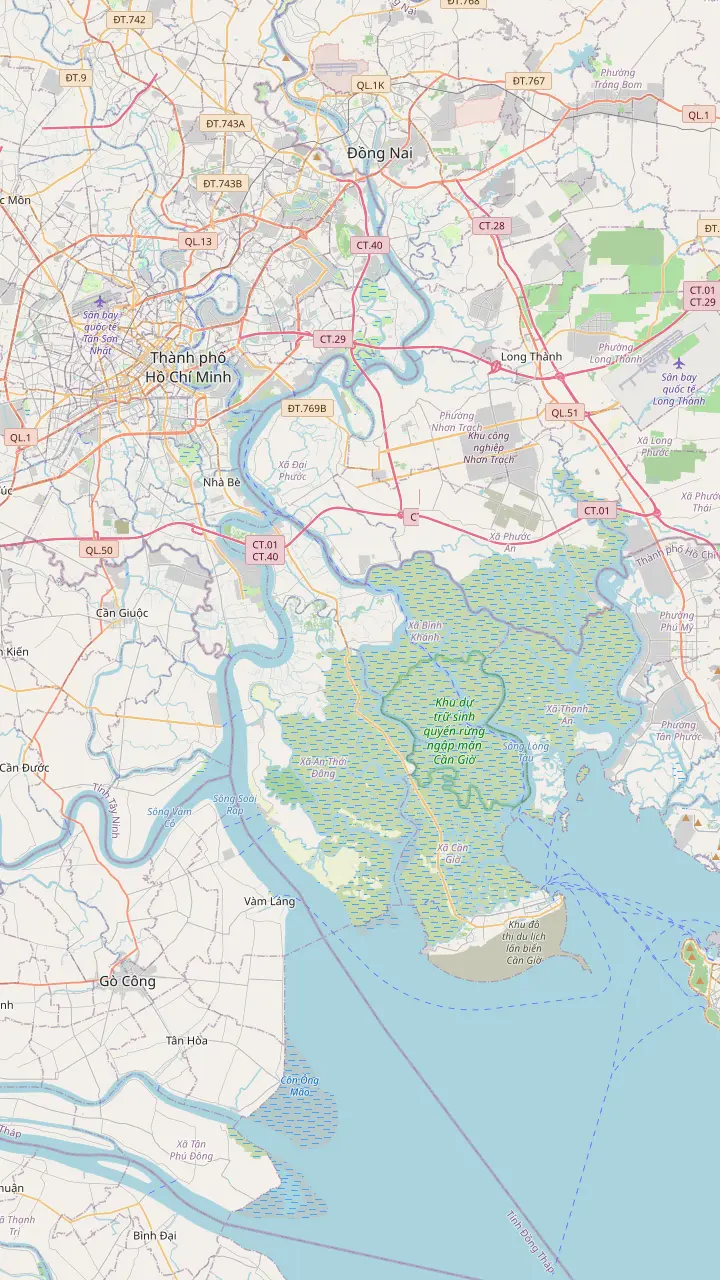
A central landmark of the city, used here only as the starting point for the road to the coast.
Google MapsThe river crossing where the road to Can Gio turns into a ferry ride. Rung Sac Road begins at this terminal.
Google MapsDirections to Vam Sat in a 2018 report cross the Vam Sat and Goc Tre bridges after the ferry.[[@vs_bridges]]
Google MapsA point on Rung Sac Road, the main road to the reserve, which runs more than 36 km from the ferry terminal.
Google MapsMonkey Island lies a short distance from the Rung Sac base, within the biosphere reserve.
Google MapsThe market in Can Gio town, a landmark for orientation. The site tour lists its own seafood market stop.
Google Maps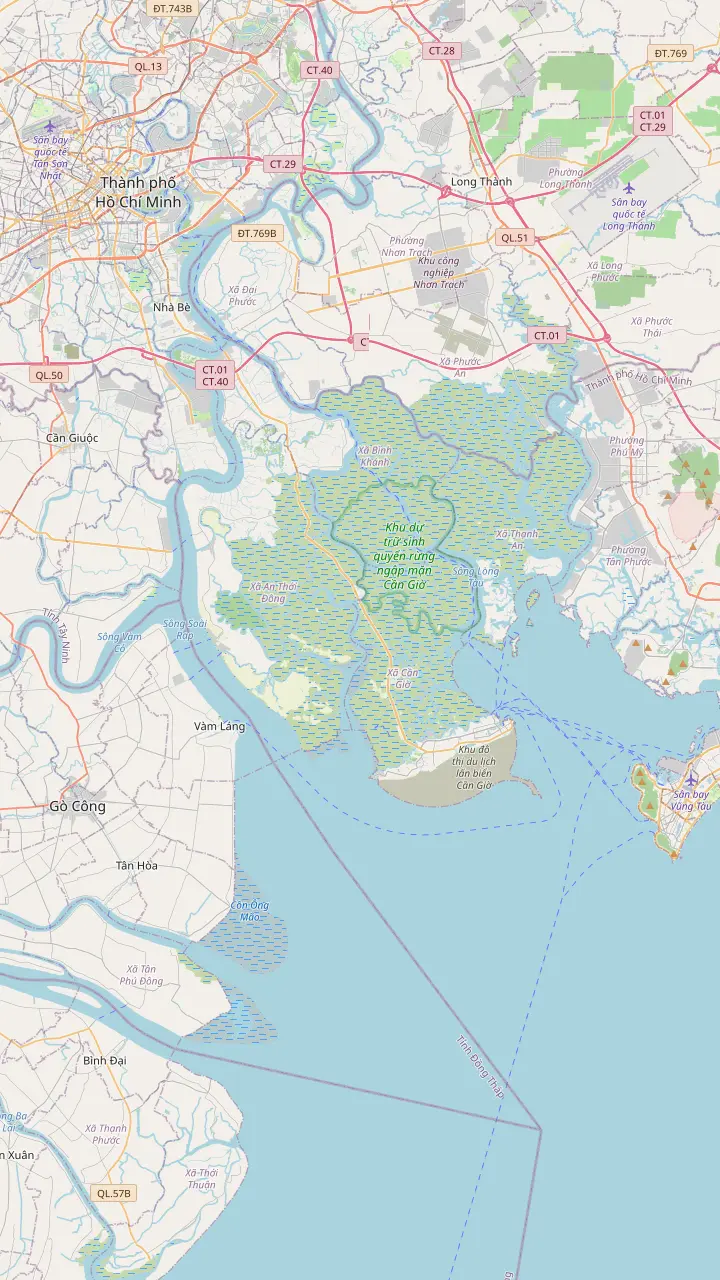
A point inside the reserve, which was recognized as a biosphere reserve on January 21, 2000.
Google MapsAn office of the body that manages the protection forest of Can Gio, set inside the forest.
Google MapsA point on Rung Sac Road, the main road to the reserve, which runs more than 36 km from the ferry terminal.
Google MapsMonkey Island lies a short distance from the Rung Sac base, within the biosphere reserve.
Google MapsDirections to Vam Sat in a 2018 report cross the Vam Sat and Goc Tre bridges after the ferry.[[@vs_bridges]]
Google MapsA 2018 report located the Vam Sat site at Ly Nhon Ward.[[@vs_lynhon]] The park gate itself is not pinned, since no verified coordinates were available.
Google MapsThe market in Can Gio town, a landmark for orientation. The site tour lists its own seafood market stop.
Google Maps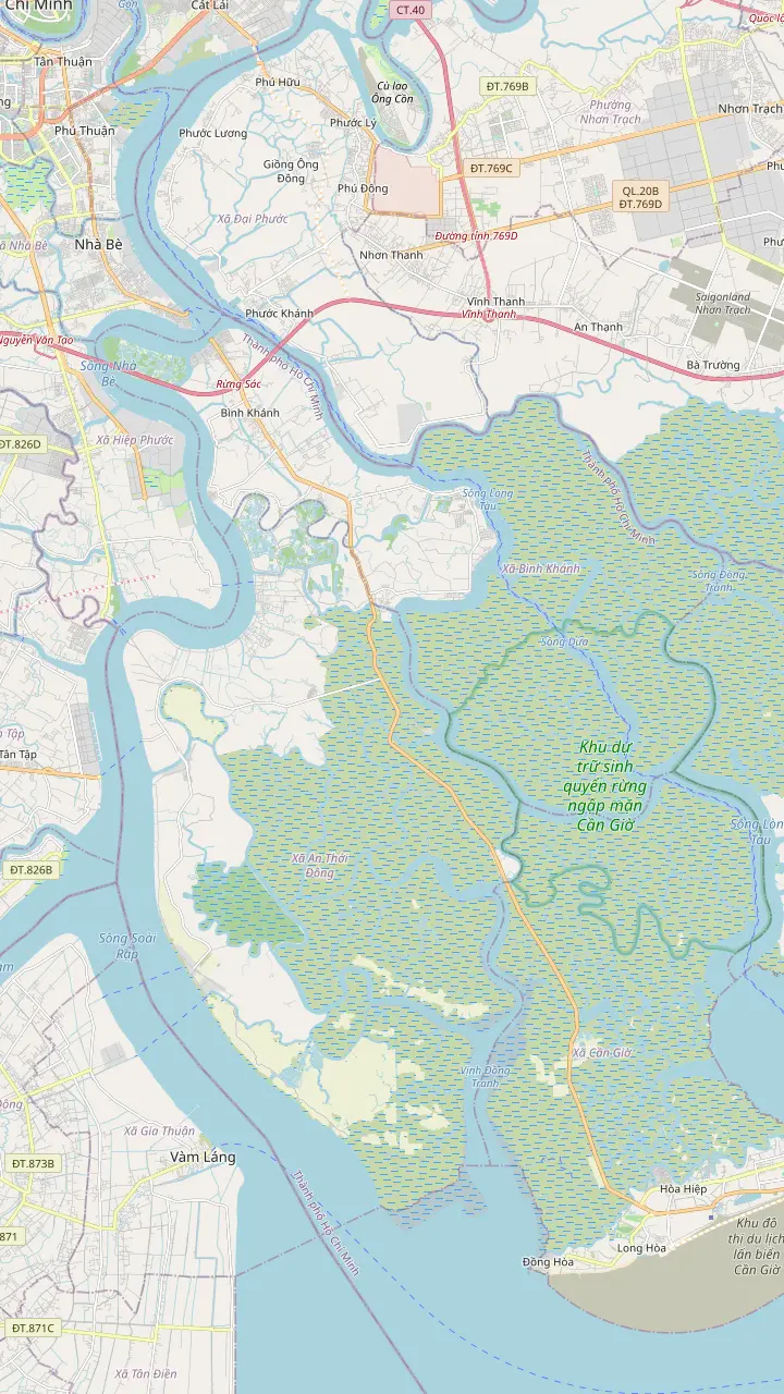
The river crossing where the road to Can Gio turns into a ferry ride. Rung Sac Road begins at this terminal.
Google MapsDirections to Vam Sat in a 2018 report cross the Vam Sat and Goc Tre bridges after the ferry.[[@vs_bridges]]
Google MapsA 2018 report located the Vam Sat site at Ly Nhon Ward.[[@vs_lynhon]] The park gate itself is not pinned, since no verified coordinates were available.
Google MapsAn office of the body that manages the protection forest of Can Gio, set inside the forest.
Google MapsA point inside the reserve, which was recognized as a biosphere reserve on January 21, 2000.
Google MapsA point on Rung Sac Road, the main road to the reserve, which runs more than 36 km from the ferry terminal.
Google Maps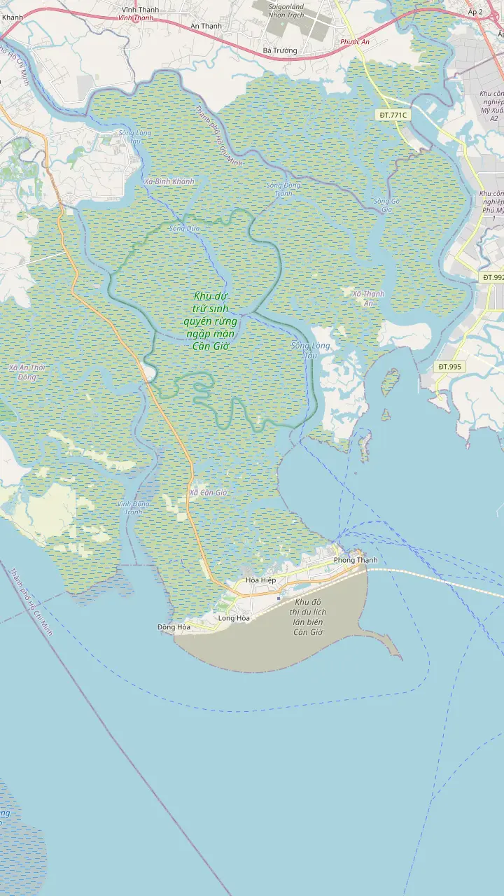
A point on Rung Sac Road, the main road to the reserve, which runs more than 36 km from the ferry terminal.
Google MapsMonkey Island lies a short distance from the Rung Sac base, within the biosphere reserve.
Google MapsAn office of the body that manages the protection forest of Can Gio, set inside the forest.
Google MapsThe market in Can Gio town, a landmark for orientation. The site tour lists its own seafood market stop.
Google MapsA point inside the reserve, which was recognized as a biosphere reserve on January 21, 2000.
Google Maps© OpenStreetMap contributors · map data
The way from the city to the mangroves runs over one road and one river crossing. Here is the distance as sources give it, the ways to cover it and what the new bridge will change.
Editorial team, cangiotour.quest · Updated November 16, 2026 · ~6 min read
Main facts
The Vietnam News Agency puts the Can Gio wetlands 50km southeast of the Ho Chi Minh City centre and says they can be visited by speedboat, car, motorbike or bus.1 The VietNamNet report on the reserve repeats the 50km figure.4 One day-tour record gives about 60 km from the city center instead, which tells you the number depends on where the measuring tape starts.
Time matters more than distance, and the sources give a range. A Tuoi Tre report says road travel from the city center to Can Gio's coastline currently takes two or three hours.3 The tour records are shorter because they start from a District 1 pickup: a van ride of 1 hour in one listing, a bus ride of 1.5 hours in others and a 2-hour car ride in a private Vam Sat day.
Treat the road figures of any Can Gio visit as a window rather than a promise. Which part of that window you meet depends on the day, the tide and the line at the crossing, and no source we found promises a fixed time. In the tour records the crossing sits inside the itinerary: the day we book lists the ferry of 15 minutes beside a bus ride of 1.5 hours. Its record also warns that the timetable can shift with the traffic, the weather or the water, so leave room in your own plans for the evening after the tour.
Side by side
| Way | From | Time | Notes |
|---|---|---|---|
| Shared day with pickup | $33 | 1.5 hours by bus | Ferry of 15 minutes |
| Private car day | $55 | 40-minute drive to the ferry | Private car from the hotel |
| Private motorbike day | $60 | 7 hours in all | Up to 10 participants |
| Private Vam Sat day | $154 | 2-hour car ride | Return at about 4:00 PM |
| Boat from Bach Dang | Not stated | Not stated | Down the Sai Gon and Soai Rap rivers7 |
| Own bike or motorbike | Not stated | Not stated | Over the Binh Khanh Ferry2 |
Starting fares for the listings; the boat and the own-vehicle routes come from a news report that gives no fare or time.7
Everything road-bound goes through the same links. Rung Sac Road is currently the only vital transport artery between Can Gio and the inner city, and it carries the entire volume of traffic to and from the Can Gio coastline.5 The river is crossed by the Binh Khanh Ferry, which crosses the river to Can Gio Street, as Viet Nam News describes it.2
The group tour lists the ferry as 15 minutes in its itinerary, and a private day tour describes a boat ride of 20 minutes to Can Gio after a 40-minute drive to the terminal. Another private day also names a 40-minute drive to the Binh Khanh Ferry from the hotel before it boards. Crossing time is short, but waiting is not counted in any of these figures.
Waiting is where the day is won or lost. A Tuoi Tre caption notes heavy traffic congestion along Nguyen Tat Thanh Street toward the Binh Khanh Ferry during peak hours.6 Our day collects guests at 7:30 AM and returns between 3:30 and 4:00 PM, so compare those hours with that peak-hour warning when you pick a date.
Time on the road
Each bar is the ride each way in that listing's own itinerary, from a District 1 pickup, so a ferry queue can move it.
The simplest way to reach the Can Gio mangrove forest from Ho Chi Minh City is to let a tour carry you. Our day starts from $33, collects guests in District 1 or at the SST Travel meeting point and finishes at one of 5 drop-off spots in Districts 1, 3, 4 and 5 or at the office. The vehicle depends on your option, from a Big Group of 35 to a VIP D-car of up to 10.
A private car day starts from $55, with a private car from the hotel at 8:00 AM, the Binh Khanh Ferry and a return to Saigon at around 5:00 PM. A private motorbike day starts from $60, lasts 7 hours, is capped at 10 participants, goes ahead in any weather and starts with a breakfast of local food along the road, with the ferry on the route.
The record for the Vam Sat private day describes a pickup at around 8:00 AM, a 2-hour car ride and a return at approximately 4:00 PM, from $154. That is the highest fare on this page, and as a private tour it is a fare for the group, not per person, so ask the operator how many people it covers. Cancelling either private option up to 24 hours ahead is free, which lets you compare dates before committing.
Pick your way
Tell us your travel style and see the fit.
If I want the lowest fare with pickup
The shared day
From $33, with pickup or a meeting point and the ferry included.
If My party wants a car to ourselves
The private car day
From $55, with a private car from the hotel at 8:00 AM.
If I like the road at street level
The motorbike day
From $60, for up to 10 participants, rain or shine.
If I want the quiet eco park end
The Vam Sat day
From $154, with a 2-hour car ride each way.
If I want to go by river
A boat from Bach Dang
Viet Nam News names the river route; no fare is stated.7
Three ways to book the road
Booked here
Bus, ferry, guide and lunch
Private
A car from the hotel
Motorbike
The ferry on two wheels
Viet Nam News describes the ways from central Ho Chi Minh City. You can bike or motorbike to the Binh Khanh Ferry, which crosses the river to Can Gio Street.2 Or you can take a boat from Bach Dang Wharf, down the Sai Gon, Soai Rap, Dinh Ba and Lo Ren rivers, which the same report calls the more interesting way.7
Going on your own means building the rest of the day yourself: the reserve gate, Monkey Island, a lunch place and the way back across the river. No official fare table for taxis, ride-hailing or a public bus to Can Gio turned up in our research, so we give none. Check the current fare with a driver or the operator before you rely on any figure you see elsewhere.
If you ride a motorbike yourself, remember that you are visiting a reserve full of animals and that the Binh Khanh Ferry is the only river crossing by road.5 A guided day takes the planning off your hands. Price your own plan, with petrol, ferry, tickets and lunch, against the fares in our price guide before you decide.
Price your seats
Enter your party size and compare the cost of each option.
Weigh up 3 options
Enter your party size and compare the cost of each option.
≈
View≈
View≈
ViewStarting prices as on the booking platform, converted at the ECB reference rate. You see the exact price at booking.
A shared day on the road
Pickup
The guide arrives at 7:30 AM in District 1, or you meet at the SST Travel office.
Drive south
The bus leg before the reserve is listed at 1.5 hours.
The river
The crossing is listed at 15 minutes.
The reserve
The record gives 2.5 hours at the Can Gio Mangrove Biosphere Reserve.
Lunch
Lunch is a break of 1.5 hours.
Heading home
A bus ride of 1.5 hours and the ferry of 15 minutes bring guests back.
Several records warn that the day bends to the water. The day we book warns that its timetable can shift with the traffic, the weather or the water. The Monkey Island day says the pickup can be later than scheduled because of a late tide, and the 8 hour small-group day says points of interest can change because of the tide of the river.
Season matters too. For Ho Chi Minh City the tourism authority marks December to April as the dry spell and May to November as the months of brief afternoon showers.11 It adds that temperatures stay around 30 degrees and describes the wet season as a regular afternoon downpour lasting a few hours.12 A morning start keeps you ahead of the afternoon downpour the authority describes.
Rain also affects the day we book: the record says it needs good weather and that a cancelled day brings a different date or a full refund. Book while the free cancellation window is open, and check the forecast the night before. If the weather looks wrong, the operator is the one who decides whether the boat and the canoe run.
Video
Max Mann on YouTube · Your tap on play is what loads the video.
Rung Sac Road is currently the only vital transport artery linking Can Gio with Ho Chi Minh City’s inner urban area, bearing the entire volume of traffic traveling to and from the Can Gio coastline.
Before you go
The road is about to change. A Tuoi Tre report says the Can Gio Bridge is slated for completion in 2029, will replace the Binh Khanh Ferry and should cut road travel from the city center to the coast to around 40-50 minutes from the current two or three hours.3 The same report says the Ben Thanh-Can Gio urban railway broke ground on December 19, 2025 and is scheduled for commercial operation in the fourth quarter of 2028.13
Once operational, that line is expected to shorten the trip from downtown to about 20 minutes.14 Those are plans, not services, so nothing here changes your day today, and the dates are those of the report. When the bridge opens, a day from the city will look different from the one on this page, and the listings will say so.
There is also a ferry that runs the other way. The Ho Chi Minh City Department of Transport approved the Can Gio-Vung Tau ferry to run between 4:00 am and 10:00 pm every day after a six-month pilot, and it cuts the trip between Can Gio and Vung Tau to 30 minutes.15,16 That is a way in from the Vung Tau side, and it does not help a visitor starting in the city.
FAQ
The Vietnam News Agency places it 50km southeast of the city centre, while a tour record says about 60 km.1
On our day the bus takes 1.5 hours and the ferry 15 minutes in each direction, while a Tuoi Tre report says two or three hours at present.3
The Binh Khanh Ferry crosses the river to Can Gio Street, and our day lists it for 15 minutes.2
Viet Nam News says visitors can bike or motorbike to the Binh Khanh Ferry, and a private motorbike day starts from $60.2
The tour records give fares for the whole day instead, such as $33 for a shared day with pickup.
Tuoi Tre says the Can Gio Bridge is slated for completion in 2029 and will replace Binh Khanh Ferry.3
The day we book collects guests at 7:30 AM from District 1 and returns between 3:30 and 4:00 PM.
Sources
Planning a Can Gio day from Saigon? Ask a real person here.